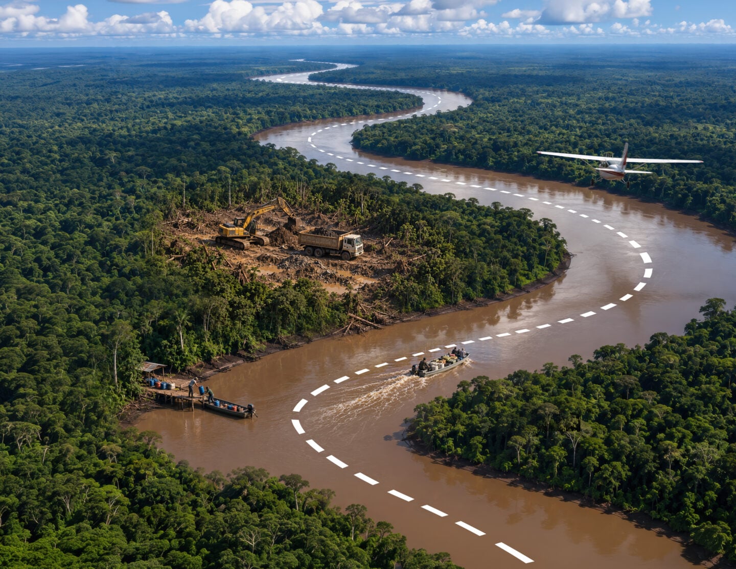
Latin America’s vast river networks are playing an increasingly important role in organized crime logistics. From the Amazon Basin to the Paraguay-Paraná Waterway, thousands of miles of rivers and tributaries cross remote areas and border regions, linking zones of cocaine production, illegal mining, and illicit natural resource exploitation to Atlantic ports and international markets. Criminal networks use these waterways to move drugs, gold, timber, and weapons, often relying on the same routes and infrastructure for multiple illicit activities.
“Rivers are at the center of this transformation, as is the ability of criminal networks to adapt and shift between different modes of transportation,” Tássio Franchi, a professor at the Brazilian Army Command and General Staff College, told Diálogo. “If police establish floating bases on the Amazon’s major rivers, criminals move to smaller rivers or alternate stretches through the jungle with flights in small aircraft.”
According to Franchi, “these are complex, interconnected routes that are difficult to systematically control.” The increase in seizures reflects the scale of the phenomenon: Between 2019 and 2024, cocaine seizures by state security forces across the nine states of the Brazilian Amazon increased 574 percent, surpassing 162 metric tons.
For security forces, the challenge is not simply to control individual routes, but to disrupt a network that spans multiple jurisdictions and can quickly shift to evade enforcement. Countering these “criminal highways” requires sustained intelligence and surveillance across rivers, land, and air, as well as close cross-border cooperation to identify not only illicit cargo, but also the criminal networks and logistics that keep it moving.
The Amazon’s major corridor
The Amazon region, which can cover more than 8.4 million square kilometers across nine countries, depending on how it is geographically defined, poses unique geographic and logistical challenges in Latin America. Its vast territory, thousands of waterways, dispersed communities, and porous borders allow criminal networks to move illicit cargo in stages, change vessels, transfer or conceal shipments, and cross multiple national borders. Rivers serve not only as transit routes, but as logistical arteries connecting production, storage, distribution, and export.
The Amazon River, known as the Solimões along its upper reaches and as the Amazon after its confluence with the Negro River, is the region’s main riverine artery, linking the Amazon interior to Atlantic routes. Cocaine, illegally mined gold, and timber move through this system, as does the fuel that supports these illicit economies. “On the Colombian side, armed groups also control illegal mining operations, which require a lot of fuel to power their machinery. That same fuel is then used to supply vessels transporting drugs and aircraft,” Franchi said.
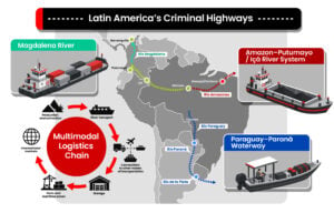
One of the region’s key riverine corridors is the Putumayo, a tributary of the Amazon River. It originates in the Colombian Andes and flows through border areas between Colombia, Ecuador, and Peru before entering Brazil, where it is known as the Içá. Cocaine from production areas in Colombia moves along this route into the wider Amazon river system, passing through a series of transshipments points on its way toward the Atlantic. Farther downstream, Manaus serves as an important logistics hub, where illicit cargo can be transferred, distributed within Brazil, or moved onward toward Atlantic export routes.
The route’s cross-border nature is also reflected in the criminal organizations operating along its different segments. Brazil’s First Capital Command (PCC) and Red Command (CV) are part of a broader network of local and transnational groups that cooperate, compete, or take on different roles along the logistics chain. The CV has expanded its presence through a flexible structure that gives local affiliates considerable autonomy. “It is a model particularly suited to an environment where control cannot be exercised uniformly, but instead must be distributed across a succession of ports, communities, islands, and transit points,” Franchi said.
Criminal groups can exert control over a corridor through temporary agreements, transit fees, armed protection, and the provision of fuel and logistical support. Along the Putumayo, Colombia’s Comandos de la Frontera have imposed rules governing river traffic and community life, extending their influence beyond illicit flows into forms of criminal governance. Along the Pureté, a tributary of the Içá, local reports indicate that drones have been used to monitor river traffic. On the Solimões, an attack on a barge near Tonantins in February 2025 highlighted the threat posed by so-called river pirates, criminal groups that target vessels and cargo traveling along Amazonian waterways.
Amapá, a new gateway to the Atlantic
Security forces’ pressure on traditional corridors has contributed to a northward shift in some Atlantic-bound routes, increasing the strategic importance of the Brazilian state of Amapá and its ports of Macapá and Santana. With no direct road connection to the rest of Brazil’s highway network and much of the state covered by rainforest, Amapá relies heavily on its river system for internal transportation and access to the Atlantic.
According to a report by the Global Initiative Against Transnational Organized Crime (GI-TOC), Amapá has emerged as an alternative outlet for Amazon trafficking routes, reducing reliance on traditional exit points in Pará. Its network of rivers, islands, and offshore anchorage areas also creates opportunities to transfer drugs onto some of the approximately 1,000 transatlantic vessels that spend days off its coast each year while traveling to and from Manaus.
Amapá’s location has also made it an increasingly important departure point for Atlantic-bound drug shipments. In March 2025, Portuguese authorities intercepted a semi-submersible in the Atlantic that had departed from Amapá carrying about 6.6 metric tons of cocaine toward the Iberian Peninsula. The case illustrated how traffickers are using the state to move large cocaine shipments from the Amazon region onto transatlantic routes.
 Other river arteries of the drug trade
Beyond the Amazon, criminal networks also exploit a very different river system: the Paraguay-Paraná Waterway, which stretches more than 3,400 kilometers through Brazil, Bolivia, Paraguay, Argentina, and Uruguay, before reaching the Atlantic through the Río de la Plata. “They are separate criminal ecosystems. Colombian and Peruvian cocaine moves along Amazonian rivers, while here the cocaine comes from Bolivia,” Franchi said.
Unlike the Amazon, where rivers provide access to remote areas, criminal organizations exploit the Paraguay-Paraná Waterway largely through its commercial logistics infrastructure: ports, terminals, warehouses, and oceangoing vessels. The waterway supports a well-established network of grain and mineral terminals, silos, shipyards, and river fleets, particularly in Paraguay. The scale of this legitimate commerce gives criminal networks opportunities to conceal illicit cargo within the large volume of goods moving along the waterway.
The PCC is one of the main criminal actors along this corridor. In Paraguay, the group stores cocaine from Bolivia and coordinates its movement toward the Río de la Plata and the Atlantic, concealing shipments in bulk cargo, vessel compartments, or containers, often without the knowledge of legitimate shippers. In August 2026, Argentine authorities disrupted an attempt to load cocaine onto a cargo ship on the Paraná River near San Nicolás. Four men were detained aboard a smaller vessel carrying seven bags containing 232 kilograms of cocaine and equipment that prosecutors said could have been used to hoist them onto the ship.
The Magdalena River in Colombia presents another riverine trafficking dynamic, linking the country’s interior with the port of Barranquilla and the Caribbean Sea. The river provides a natural corridor for moving drugs from inland areas toward ports and international maritime routes, reducing reliance on overland transportation. Large seizures near the river’s mouth illustrate the role of this Caribbean outlet. In September 2025, authorities seized 1,675 kg of cocaine aboard a go-fast vessel near Bocas de Ceniza, where the Magdalena meets the Caribbean Sea.
Toward a regional riverine intelligence capability
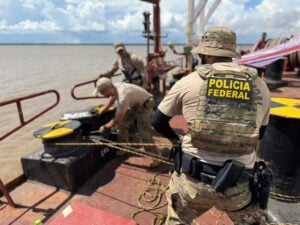
As criminal organizations adapt their routes and methods, Latin American security forces are responding with expanded patrols, intelligence sharing, port controls, and cross-border operations. In the Amazon, Brazil combines the presence of its Armed Forces with joint law enforcement and intelligence operations.
In January 2026, Brazil’s Federal Police and the Colombian Navy signed a protocol to exchange intelligence on organized crime along cross-border rivers in the Amazon. Cooperation extends to other neighboring countries as well. In August, Brazil’s Federal Police, the Peruvian National Police, and the Peruvian Armed Forces conducted air, riverine, and ground actions during Operation Amazon 2026 in Peru’s Mariscal Ramón Castilla province, destroying drug laboratories, clandestine airstrips, and other infrastructure used by transnational criminal organizations.
Authorities are also expanding surveillance and coordination along the Paraguay-Paraná Waterway. Argentina launched Plan Paraná in 2025, bringing together the Federal Police, Gendarmerie, Naval Prefecture, and other agencies in patrol and surveillance operations supported by radar, drones, thermal cameras, scanners, and criminal and financial intelligence. In June, Paraguay and Argentina expanded cross-border coordination through the binational Operation Costa Franca, conducting joint patrols along the Paraguay and Paraná rivers and nearby border areas. Paraguay is also improving monitoring of the waterway through real-time systems that integrate data on river levels, vessel locations, and navigation conditions with sensors, smart buoys, and Automatic Identification System (AIS) technology.
This regional approach is also reflected in broader initiatives such as the Americas Counter-Cartel Coalition, which seeks to strengthen intelligence sharing and coordination against transnational criminal networks. During the coalition’s forum in Panama in August 2026, participating countries emphasized the need to connect capabilities and operations across national borders, an approach particularly relevant to river corridors spanning multiple jurisdictions.
For Franchi, these technologies deliver their greatest value when integrated with regional cooperation. Their effectiveness “depends on the ability to integrate them with intelligence among countries and to harmonize legislation and judicial systems.” Such integration can help build a permanent regional riverine intelligence capability combining operational, environmental, financial, and judicial data. Tracking networks across borders and throughout the logistics chain enables authorities to move beyond intercepting individual shipments to identifying and dismantling the structures that move them, reducing their ability to shift operations from one river or country to another.