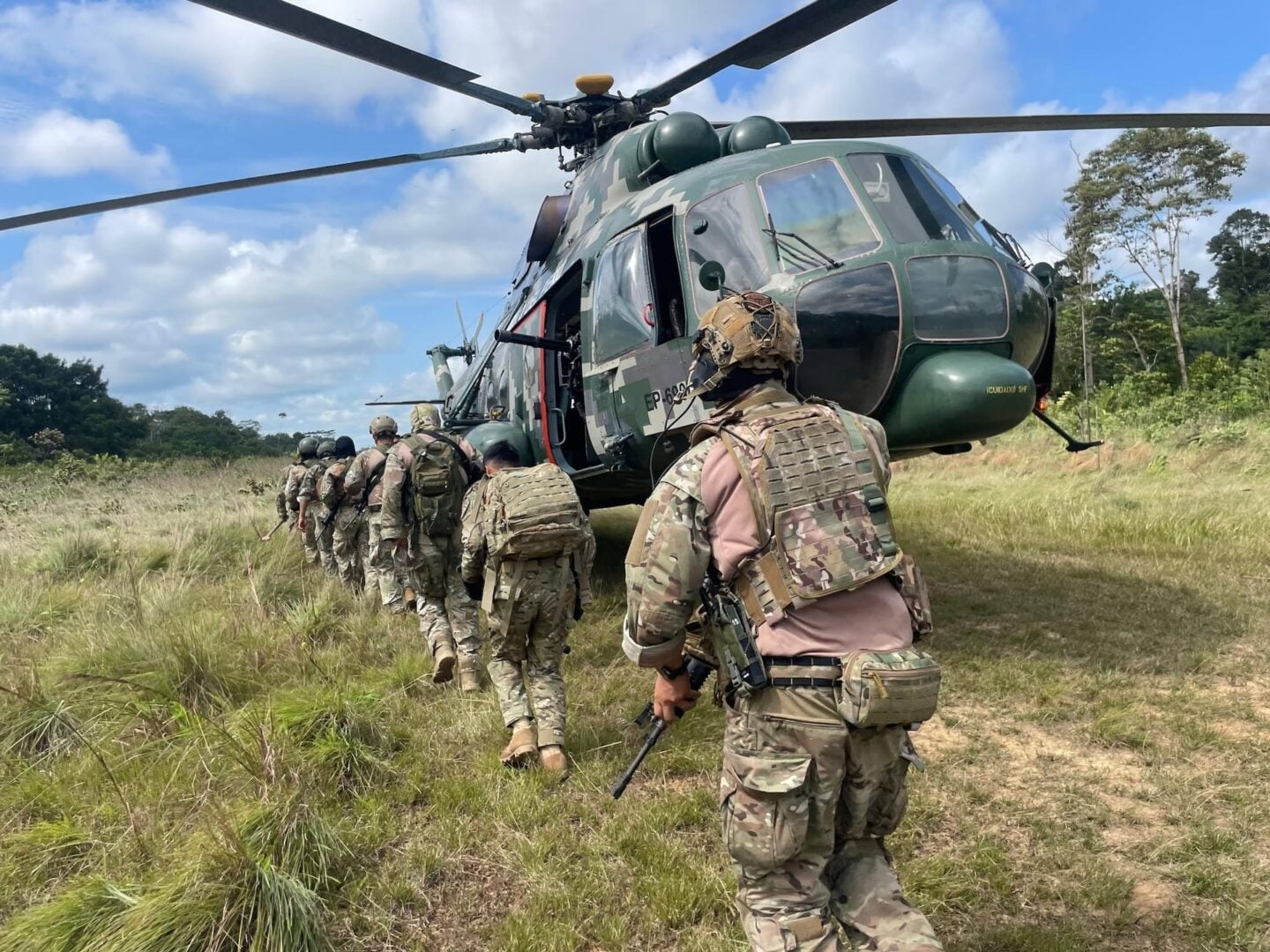

Recent operations in the Peruvian Amazon have exposed how cocaine trafficking networks are using clandestine airstrips to move drug shipments toward Brazil, Bolivia, and other international markets. Since August, authorities in Loreto and Cusco have combined aerial reconnaissance, drones, intelligence, information from local communities, and ground patrols to locate and disrupt these trafficking routes, América Noticias reported.
The region’s geography gives traffickers an advantage. Vast distances, dense vegetation, and limited road access make it difficult for authorities to maintain a sustained presence, while light aircraft provide criminal organizations with an efficient way to move drugs across remote areas.
Ricardo Soberón Garrido, a Peruvian attorney and expert on organized crime policy, explained to Diálogo how this infrastructure developed. “In the Colombian-Venezuelan Orinoco region and the savannas and Amazon forests of Loreto and Ucayali, cattle ranching and large estates depend on small aircraft for surveillance, spraying, and moving livestock,” he said. “This has created an extensive network of airstrips that conceals a large market for new and used aircraft diverted to transport coca paste and cocaine hydrochloride.”
The sheer size of the network makes it difficult to disrupt. “There are more than 400 clandestine airstrips in the Peruvian Amazon, allowing organizations to choose their landing site at the last minute and evade any ground intervention,” Soberón said. “Air transport allows them to move loads of up to a ton of drugs, saving the organizations time and money.”
Integrated surveillance
Monitoring these remote trafficking corridors increasingly draws on satellite imagery. PerúSAT-1, operated by Peru’s National Commission for Aerospace Research and Development (CONIDA), marked a decade in orbit in September. According to CONIDA, its high-resolution imagery supports efforts to monitor illicit activity and identify clandestine airstrips, illegal camps, and makeshift roads in hard-to-reach areas.
Satellite imagery complements reconnaissance by drones and helicopters and information gathered by ground patrols, giving authorities a broader picture of potential targets before teams are deployed to verify them.
That combination of capabilities was put into practice September 8 in Cusco’s La Convención province. Drones and helicopters from the VRAEM Special Command located six operational airstrips in Taini and Alto Pisha, across the districts of Megantoni, Echarati, and Kumpirushiato. Aerial surveillance narrowed the search area and guided military engineers and counternarcotics agents to the targets, Canal N reported.
Air-ground coordination was also critical during Operation Jaguar, carried out August 6 in Loreto. The Armed Forces and National Police targeted a clandestine airstrip and an active coca paste laboratory near the Bellavista de Callarú native community. Patrols disabled the equipment and supplies supporting the operation, according to the Armed Forces Joint Command.
Criminal logistics
Disabling an airstrip does not necessarily put it out of use for good. Following the operation in La Convención, security forces said intelligence efforts and joint patrols would continue, according to Perú 21.
That follow-up is aimed at preventing criminal groups from reactivating the sites. By monitoring previously targeted locations, authorities can detect changes on the ground, identify signs of reconstruction, and launch new operations when necessary.
Preventing airstrips from returning to operation also means disrupting the logistics networks that supply them and connect them to drug production sites. In the Peruate community in Loreto, a joint National Police-Armed Forces operation destroyed a large-scale drug laboratory that included nine structures used to store supplies and three storage areas containing engines and tools, Andina news agency reported. The operation disrupted both drug production and the logistical infrastructure needed to supply and sustain the site.
On August 21, in the Platanal native community, also in Loreto, the Amazon Operational Command and the Putumayo and Mariscal Ramón Castilla Unified Command destroyed two laboratories and a camp. The camp included sleeping quarters, a kitchen, a mechanical workshop, a food storage facility, and a port facility. By targeting this supportive infrastructure, security forces can make it more difficult for criminal organizations to rebuild, resupply, and resume operations.
Aerial surveillance
Ground control has its limits as long as criminal organizations retain the ability to use the airspace. “Given the ‘Amazonization’ of illicit economies and the logistical importance of air transportation, the threat of interception and shootdown is an effective tool for deterring suspicious flights,” Soberón said.
Because air transportation is so important to these networks, Peru is also strengthening its surveillance and interoperability capabilities through international cooperation. From August 27 to September 2, for example, Peruvian Air Force personnel participated in surveillance missions aboard a U.S. P-3 Orion aircraft. The teams used radar and a forward-looking infrared (FLIR) camera working alongside personnel from Peru’s Air Operational Command and Air Defense Operational Command, which are responsible for monitoring the country’s airspace.
Multinational cooperation extends those efforts beyond national borders. On September 7, the World Customs Organization confirmed that Operation COLIBRI ZAFIRO brought together customs, police, counternarcotics, aviation, and military authorities from 19 countries for 16 days. Using advance risk analysis, three coordination centers, a geoportal, and a secure information-sharing platform, participants conducted 1,431 checks, identified 86 clandestine airstrips, seized 11 light aircraft, and confiscated nearly 1.2 tons of narcotics.
Information from the checks recorded in the geoportal feeds into a shared database that allows analysts to identify recurring aircraft, repeated routes, and discrepancies between declared flights and actual movements. When a risk profile is detected, alerts can prompt coordinated checks across participating countries.
The need for cross-border coordination is also reflected in the Americas Counter-Cartel Coalition, in which Peru participates. The regional initiative seeks to strengthen information sharing and operational coordination against transnational criminal organizations that exploit borders and connect illicit activities across multiple jurisdictions.
Peru’s experience shows that a clandestine airstrip is only one node in a broader logistics network. Disabling an airstrip can temporarily disrupt operations, but sustaining that disruption also requires identifying the aircraft, laboratories, river routes, storage sites, and supply networks that allow criminal organizations to rebuild.
Integrating satellite surveillance, aerial reconnaissance, intelligence, ground patrols, and airspace control expands the ability of Peruvian forces to target that network as a whole. Multinational initiatives such as COLIBRI ZAFIRO add another layer, enabling countries to share alerts and flight patterns across jurisdictions, track aircraft and routes beyond national borders, and turn dispersed information into coordinated operations against criminal logistics networks that operate on a regional scale.