The time to act to stop illegal, unreported, and unregulated (IUU) fishing is now. IUU fishing is among the greatest threats to marine ecosystems and the sustainable management of ocean resources, generating negative economic, security, and social impacts for legitimate fishers and coastal communities around the globe.
Cutting-edge technology to turn data into actionable information to combat IUU fishing is a priority for Global Fishing Watch (GFW), an international non-profit organization dedicated to advancing the sustainability of marine resources.
Mónica Espinoza Miralles, GFW senior program manager – Latin America, spoke with Diálogo about the new technology that helps to deter this global threat.
Diálogo: IUU fishing accounts for as much as 20 percent of the global seafood catch with annual losses valued at up to $23.5 billion. It’s a global problem that threatens ocean ecosystems and sustainable fisheries, and China is its biggest culprit worldwide. How is GFW contributing to ocean governance and efforts to curb IUU fishing?
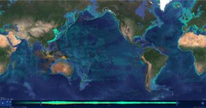
Mónica Espinoza Miralles, GFW senior program manager – Latin America: We seek to advance ocean governance through the increased transparency of human activity at sea and our technology can help governments to take actions. Transparency is key for ocean managers and government authorities to have access to information about the ocean and vessel data, helping the policies and decisions that surround actions for a cost effective and scalable approach to fisheries governance. As we make this information both available and accessible, we are creating and publicly sharing a visualization of data and creating an analysis tool that will enable scientific research to drive transformation of how we manage our oceans.
For example, one of our researcher’s team published a paper that talked about an IUU fishing activity in North Korean waters, and as a result, North Korea was put on United Nations sanctions that forbid foreign fishing in their waters. This is the power of transparent data, so we can see behaviors that shouldn’t be there and also reward those that are compliant.
Diálogo: Let’s talk about vessels that intentionally disable their Automatic Identification System (AIS), which broadcast their location, and the strong link to IUU fishing. What is the importance of AIS for the fight against IUU fishing?
Espinoza: AIS was designed for safety at sea. The majority of vessels operating at sea uses AIS to communicate with each other; this information is broadcast publicly. GFW has access to this data and maps it. AIS signals are received by satellites and some of them may be lost when vessels are in a very crowded area like the Gulf of Mexico or South China Sea, which can create some interference. One of our challenges with AIS is that in some cases the vessels can offset or fake their positions, so they might be operating in one location, but appearing in another area. However, we use algorithm and techniques to determine accurate vessel identities that in some cases are able to identify if the vessel intentionally disabled their device and reconstructed their true location.
Diálogo: The Vessel Monitoring System (VMS) tracks vessels in a similar way to AIS but has historically been restricted to government regulators or other fisheries authorities. GFW lauded some Latin American states for making their VMS publicly available. Has China, which fishing fleets operate year-round, released their VMS?
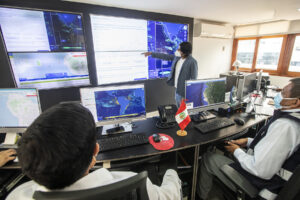
Espinoza: VMS information is managed in a confidential way by countries. Now we are able to demonstrate that this data can be shared publicly and we’re able to present this information with a three-day delay. Currently, in Latin America, Belize, Brazil, Chile, Costa Rica, Ecuador, Panama, and Peru are publicly sharing their VMS data. China does not share its VMS data publicly, but they do have one of the largest distant-water fleets in the world that are equipped with AIS devices, so we are able to see where those vessels operate and highlight their activity. We don’t tend to investigate on a specific flag. We use all the available data and technology to conduct analysis and studies to help address the most pressing challenges that our ocean faces.
Diálogo: Vessel tracking data is critical for tracking commercial fishing activity but monitoring AIS and VMS still leaves out a significant portion of global fishing activity. How can satellite imagery systems detect vessels that have no tracking devices or those whose tracking devices have been switched off to conceal their location?
Espinoza: The base/foundation of our technology are AIS and VMS data, but we use a novel combination of satellite radar, detection of light during nighttime, satellite-based synthetic aperture radar (SAR) imagery that detects metal objects at sea, and optical imagery. All of these are useful for mapping where the vessels are and they provide different information than tracking signals, especially where there is currently a lack of public vessel tracking information. That’s why there is a need for more transparency in vessel tracking.
Diálogo: Ecuador, Argentina, Peru, and Costa Rica are some of the countries in Latin America that suffer most from the impact of IUU fishing from Chinese fishing fleets. What can be done to stop this situation?
Espinoza: Some countries that face challenges around IUU fishing are taking actions in terms of policies and measures to increase the transparency of other vessels. A really good example is Peru, which has a port that gives support to long distance vessels (gas, maintenance, crews, etc.). Currently, Peru demands that foreign flagged vessels must transmit the last six months of their tracking information to the authorities to be able to access their ports.
Diálogo: What kind of international cooperation exists in Latin America to locate and track in real time ships whose transponders are turned off to evade monitoring by authorities when they engage in illegal fishing activities?
Espinoza: The real time factor is still quite a challenge. There are different initiatives that we are trying to develop to track these dark vessels in real time. For example, we won a grant from The Audacious Project with our proposal for an Open Ocean Project, the first ever map to publicly visualize all tracked global fishing activity in near real time in the next five years. It’s important to have partnerships and collaborations and there are many countries working together to address this common challenge. A part of that is, for example, the partnership we are building with countries where we can offer them insights and data to take action and for them to share their information publicly through GFW.
Diálogo: Can you give examples where GFW was able to identify large IUU fishing hotspots? Do you have examples for Latin America?
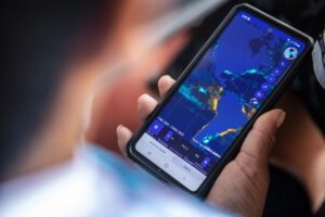
Espinoza: We were able to identify some of the hotspot areas of unregulated fishing for jumbo squid fishery in the Southeast Pacific Ocean. We were able to reveal an increase of these vessels by 800 percent since 2019 from 2009, putting a huge pressure on the resources that sustain a whole fishing communities and a globally important ecosystem. Through data visualization, we brought this information into the media and it sparked a global outcry. We were able to see afterward the power of transparency in driving accountability, resulting in a change on how vessels operate by keeping them at least at 80 nautical mile away from, for example, the Galapagos exclusive economic zone.
Diálogo: How does GFW work together with the United States to combat IUU fishing?
Espinoza: We signed with the United States, Canada, and United Kingdom an international alliance to increase fisheries transparency and end IUU fishing on June 2022. We have a partnership agreement with U.S. Southern Command (SOUTHCOM), where we provide public vessel tracking data and open maritime domain awareness tools to support the defense agency’s efforts to counter IUU fishing in SOUTHCOM’s area of responsibility in Latin America and the Caribbean. It also includes workshops and subject matter exchanges to enhance cooperation between partners and the use of GFW’s technology and open data. We also collaborate with the U.S. Coast Guard.
